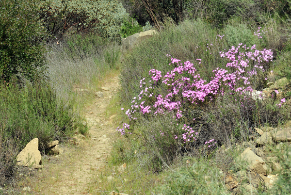
There are numerous trails in the Santa Barbara area suitable for cross country trail running.
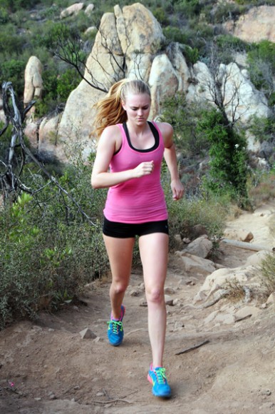
Santa Barbara is widely known for its excellent and varied trail running opportunities located in the front country overlooking the city. Trail running has progressively increased over the years and is now one of the most popular forms of outdoor activity in Santa Barbara County.
These suggested trails feature fantastic natural qualities ranging from picturesque views, swimming holes, waterfalls, wildlife, riparian forests, and more depending on the time of year.
Below is a select list of some of the best trails in the area suited for running.
LOCAL SANTA BARBARA TRAIL RUNS
Most frontcountry trails have at least some elevation gain, with some steep climbs totaling up to 3,000 feet.
SAN ANTONIO CREEK TRAIL
LENGTH: 1 ? miles
ELEVATION GAIN: 300?
DIFFICULTY: Easy
WHERE: Goleta
Take the Turnpike exit from Hwy 101 and go north to Foothill. Drive ? mile through Tucker?s Grove to the last parking lot, just before Kiwanis Meadow. This is a nice, short trail, perfect for small children, through tall trees and canyon vegetation. The path is very easy to follow and also leads to smaller trails to the creek.JESUSITA TRAIL
LENGTH: 4 ? miles
ELEVATION GAIN: 1225?
DIFFICULTY: Easy to medium
WHERE: Santa Barbara
From Hwy 101, take the Las Positas exit north. After crossing State Street, it then becomes San Roque Road. This trail begins at Steven?s Park (turn left at Calle Fresno and then right into the park). While the park offers the possibility of combining a picnic following a trail run up the canyon, a longer run up to Inspiration Point provides a beautiful view of Santa Barbara that is worthwhile.TUNNEL TRAIL
LENGTH: 4 miles
ELEVATION GAIN: 3000?
DIFFICULTY: Hard
WHERE: Santa Barbara (La Cumbre Peak is 1 mile west from the trail?s end)
Take Mission Street exit off Hwy 101, drive past The Mission and turn right on Foothill Road and then a left at Mission Canyon. Turn to the left on Tunnel Road and go straight for a mile to the end until you reach a locked gate. This trail presents numerous offshoots, from swimming holes in Mission Canyon to views atop Inspiration Point, or to the crest where hang gliders soar. A connecting trail leads to Rattlesnake Canyon, which allows a nice loop trail run.RATTLESNAKE CANYON TRAIL
LENGTH: 1 ? miles to Tunnel Trail (3.5 miles roundtrip)
ELEVATION GAIN: 1000?
DIFFICULTY: Medium
WHERE: Santa Barbara (Add ? mile and 500? elevation gain to Gibraltar Road)
Follow same directions for Tunnel Trail except continue past Tunnel Road to Las Canoas. Turn right and go 1/2 mile to the trailhead before a stone bridge near Skofield Park. This is a beautiful canyon trail run with many waterfalls, pools, and creeks. Rattlesnake Canyon provides excellent short trails for tempo runs. This trail is great for children as well. It is also designated as a nature preserve.WEST FORK COLD SPRINGS CANYON
LENGTH: 1 ? mile
ELEVATION GAIN: 1200?
DIFFICULTY: Medium
WHERE: Santa Barbara/Montecito
Take Milpas exit off Hwy 101, turn right onto Montecito Street and follow it up north to Sycamore Canyon. Continue on this road for 2 miles until you hit Cold Springs Road. Turn left and drive 1 mile to Mountain Road and turn right. The trailhead is ? mile ahead. The West Fork Trail begins ? mile up from the trailhead. This is a gorgeous canyon with great views. West Fork Canyon is not recommended for children. It can lead to Gibraltar Road or to a waterfall in the Middle Fork of Cold Springs Canyon.EAST FORK COLD SPRINGS CANYON
LENGTH: 1 ? miles to Montecito Overlook, 3 ? miles to Montecito Peak, or 4 ? miles to Camino Cielo
ELEVATION GAIN: 2600?
DIFFICULTY: Medium to Hard
WHERE: Santa Barbara/Montecito
Follow same directions for West Fork. This trail has beautiful pools for a day filled with sunbathing and picnics, or the possibility of a longer trail run leading to spectacular overlooks. A long looped run is achievable by continuing back down the San Ysidro Trail or a shorter loop by taking the connecting trail into Hot Springs Canyon. Children should be careful on this trail due to the steep hills along the trail in certain areas.SAN YSIDRO CANYON
LENGTH: 1 ? miles to waterfall, 4 ? miles to Camino Cielo
ELEVATION GAIN: 2900?
DIFFICULTY: Medium to Hard
WHERE: Montecito
From Hwy 101, follow San Ysidro Road for 1 mile until you reach East Valley Road. Turn right and go 1 mile to Park Lane and then left ? mile to Mountain Drive. Turn left again at the Y in the road and look for the trailhead at the end of the block. The trail is fairly narrow and passes through private property. It then opens to a dirt road that you can follow to the upper canyon. This trail can loop into Hot Springs or Romero Canyon.ROMERO CANYON
LENGTH: 4 miles
ELEVATION GAIN: 2200?
DIFFICULTY: Hard
WHERE: Montecito
From Hwy 101, take Sheffield Drive exit. Follow 1 ? miles to East Valley, then 1 ? miles north on Romero Canyon Road. Turn right on Bella Vista and drive 1/3 mile to the gate. The trail intertwines with the old Romero Canyon Road, offering the option of a loop trip within this trail. This is a scenic trail through the chaparral and tends to be rather quiet.GIBRALTAR RECREATION AREA (Santa Barbara Backcountry)
LENGTH: 3 miles
ELEVATION GAIN: 800?
DIFFICULTY: Easy
WHERE: Little Pine Mountain
Follow Paradise Road 10 miles to the end at an open parking area near locked gates. A dirt road along the river leads to Redrock and numerous other pools, which eventually leads you to Gibraltar Reservoir where many people fish (you must have a permit to do so). For more information, contact the Forest Service or Santa Barbara City Recreation Department. For the return trip, you might follow the high road, which provides beautiful views of the river and pools.


“There are numerous trails in the Santa Barbara area suitable for cross country trail running. ”
I do not agree:
https://www.dmagazine.com/health-fitness/2014/10/the-best-dallas-running-trails/